

_Franco Montalto
Montalto is a professor of civil, architectural and environmental engineering, with research interests in the effects of built infrastructure on societal water needs, green design and more.
At the northern terminus of Camden, New Jersey, where the city’s grid of streets gives way to the banks of the Delaware River, a pipe some 8 feet in diameter empties into the waterway.
This is the largest of two dozen outfalls for the county’s combined sewer system, a relic of 19th century infrastructure that persists in some older cities. Early planners designed them to carry household sewage and stormwater through the same pipes to the treatment plant, with overflows into a nearby body of water only during high flow conditions — a great improvement over open cesspools that had previously been standard.
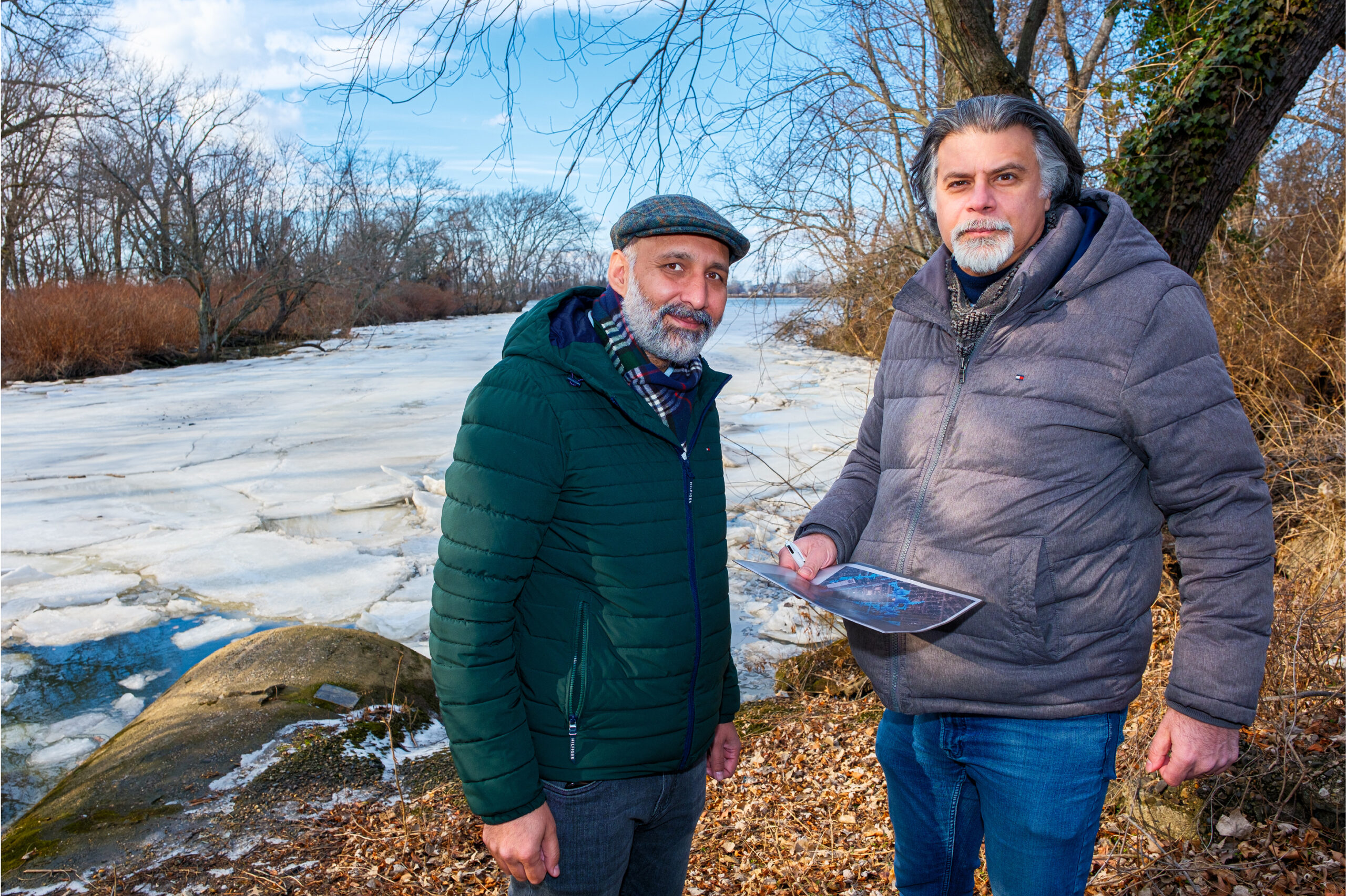
Drexel’s Haseeb Payab and Franco Montalto survey an outfall waterway in Camden.
But when it rains here, Camden’s pipes don’t just overflow, they also cause water to back up into streets and basements.
This has long been an ecological dilemma, but the stage is set for it to become a major public health hazard, too. The problem is exacerbated when heavy rainfall coincides with high tide — or worse, a storm surge.
As sea levels rise and superstorms gather, the stormwater infrastructure could become overwhelmed on a more regular basis, adding to the plight of a community already afflicted with frequent street flooding and a host of environmental injustices wrought by a history of industrial pollution, including poor air and water quality, and industrial brownfields. The burden could soon become untenable.
Watching_for_water
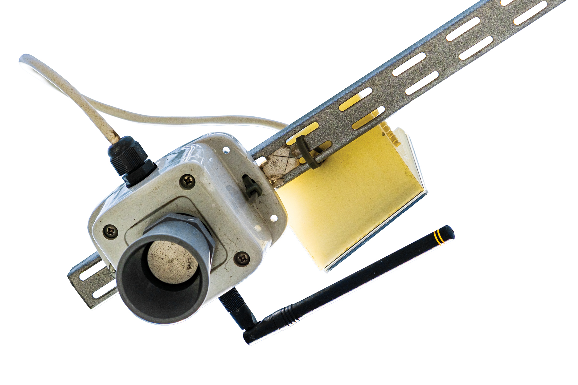
One of a number of flood sensors Montalto’s team has set up around Camden.
The Search for Solutions
On a brisk, sunny day in late January, as winds whip past in heavy gusts, Drexel Professor Franco Montalto and Research Scientist Haseeb Payab stand overlooking the outfall, pondering solutions.
It’s high tide, so only a portion of the pipe is revealed. The river’s edge, iced over in mid-winter, looks placid, but its waters reveal the depth of Camden’s challenges: an outdated sewer system, a community plagued by the system’s shortcomings, and a dearth of investment and expertise to bail its way out.
For nearly 15 years, Montalto, a civil and environmental engineer, has worked with the Camden County Municipal Utilities Authority to tackle flooding and water-quality concerns. Using flood sensors and computer models, he and his team have provided the county with its first detailed understanding of the scope of its flooding — and the infrastructure changes needed to address it. By factoring in anticipated sea level rise and extreme rainfall, the models give the city hard data to address present-day concerns and prevent future crises.
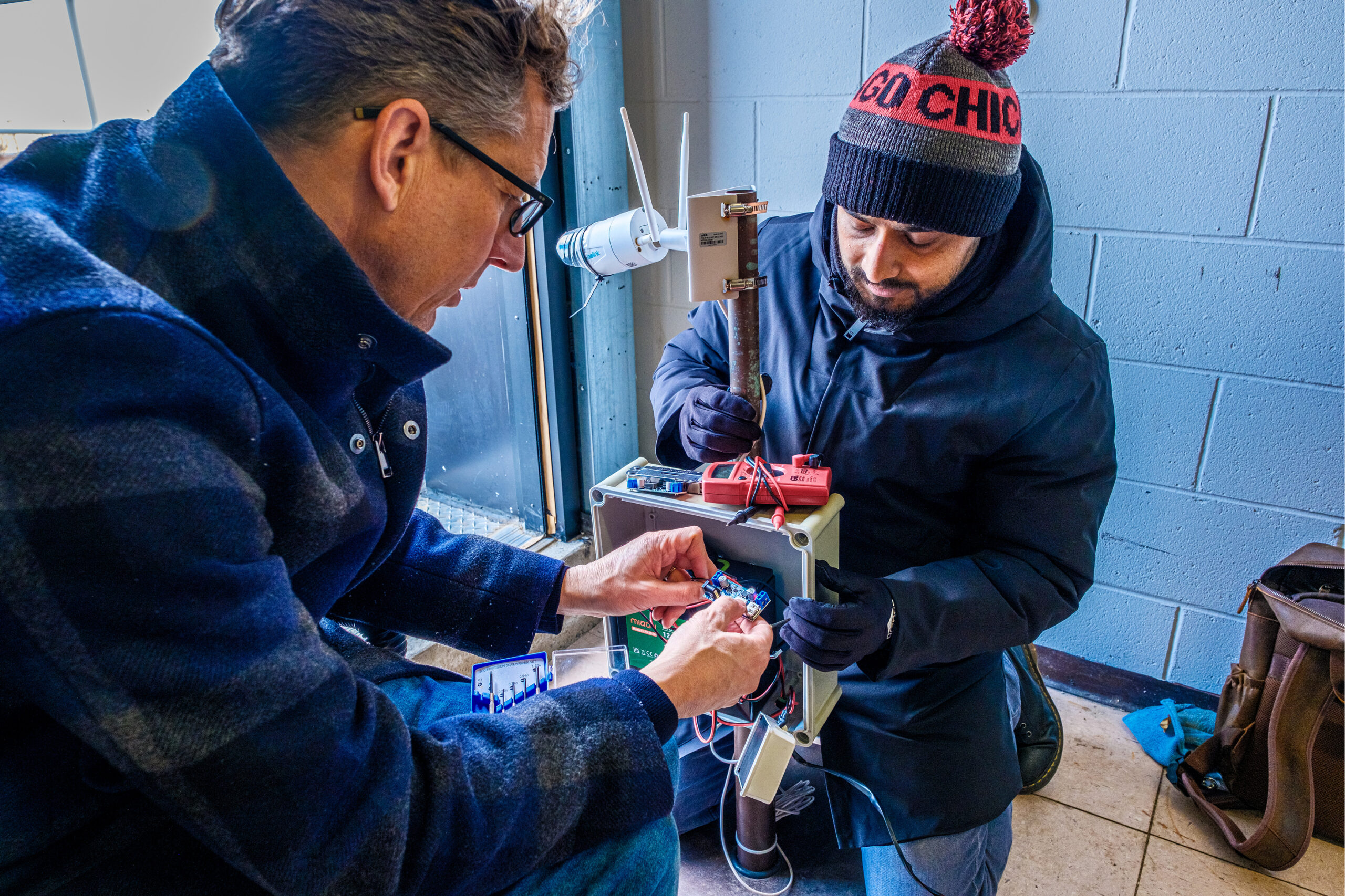
Philip Orton and Nirajan Adhikari repair a camera they use to monitor floods.
Today, Montalto and Payab are scouting for opportunities to divert stormwater in the Cramer Hill section of Camden, where street flooding is a regular nuisance. Signs of the problem are everywhere: damaged home siding, cracked and cratered pavement, debris blocking drains.
Payab explains why their work is so crucial to dealing with Camden’s flooding. Seeking a solution, he says, is like going to the doctor and saying you feel pain. Without testing to identify the source, it’s impossible to offer a salve.
“Only once you run the models do you know what the specific problem is,” he says.
Camden’s flooding could stem from its low elevation and topography, aged and infrequently maintained assets, a proliferation of impervious surfaces, or a lack of green space to safely absorb rainfall.
Perhaps it’s a bit of everything. Any fix based on an incomplete picture will be, at least partly, shots in the dark.
“It’s inefficient, ineffective and costly if you don’t know the real origin of the problem,” Payab says. “Modeling helps.”
As they walk down River Avenue, which slopes toward Von Nieda Park, Montalto notes the area on a map. The map shows that, in the event of a once-in-a-decade storm, the majority of this area will be under water.
Many storm inlets are completely clogged, making it clear why even modest rainfall leads to pooling and rushing water.
They stop at Von Nieda Park, which is built on a former creek and now includes a depression that collects water during storms. More parks like this, Montalto says, could act as green infrastructure, offering public spaces on dry days and stormwater sinks on wet ones. Fresh off a recent trip to Copenhagen, he describes that city’s ambitious cloudburst management plan, which separated storm and waste water and introduced multi-purpose parks like this one. Copenhagen is rolling out 300 projects to deal with heavier downpours — an investment of well over $1 billion.
By contrast, Camden has a budget one-fourth that size, a 28.5% poverty rate, and a deficit chipping away at public services. Camden can’t dream of funds like that — but with targeted, data-backed plans, the city can pursue smaller interventions.
“There will be the New Yorks of the world that have a whole section of the mayor’s office focused on these issues, but then there are communities like Camden, that are much more numerous, that don’t have the capacity to go at it,” Montalto says. “They’re facing the same risks, but they haven’t quantified those risks and they don’t have the resources to fully evaluate options.”
“Where I live…if there was one day with sewage running down the street, there would be immediate intervention. In Camden, It’s just part of life, and that’s totally unfair.”
—Scott Schreiber
This is where Montalto and his colleagues come in — both those at Drexel and in the broader academic community.
“Universities can be a knowledge broker,” he says. “Through student projects and research, we can provide the analysis. We can provide some high-level ideation on potential alternative courses of action. We can bring the latest and greatest science to bear on local problems in places where there might not be a chief resiliency or sustainability officer.”
The Old College Try
On that same afternoon in the Waterfront South neighborhood of Camden, Nirajan Adhikari, a College of Engineering doctoral student working with Montalto, and Philip Orton, a research associate professor at Stevens Institute of Technology in Hoboken, New Jersey, brace against the wind ripping across the roof of the five-story headquarters of the Camden County Municipal Utilities Authority, the regional water resource recovery utility.
Orton and Montalto are members of the Consortium for Climate Risk in the Urban Northeast, which formed in 2010. The group of experts and scholars from universities and research organizations seeks to partner with cities to address problems like these. In 2023, they released a research agenda to help the Philadelphia area build resilience to extreme weather. They foresee the region battling sea level rise, hotter and wetter weather, and risks of drinking water contamination from salinity and chemicals.
Orton and Adhikari are here to check a solar-powered camera on the fritz that’s recently stopped surveilling the streets below. The researchers have also installed sensors that train ultrasonic beams on the pavement to record floodwaters during storms, which they’ll use to refine their models. But the sensors only track the height of flooding at a specific point; the camera offers a visual of the scene when flooding is identified so the team can better understand how it manifests. Most days, Orton is in a classroom teaching about sea level rise and storm surge, but today’s work is all technical — attaching wires and fiddling with hardware to get the camera back in action.
At street level, Montalto shows off one of the flood sensors, which is attached to a pole supporting a traffic light overhead. He first got involved in Camden to show his hydrologic modeling class how they could solve real-world problems, combining classroom learning with hands-on field experience in line with Drexel’s experiential learning model. He and his students have also done similar work in Philadelphia’s Eastwick neighborhood.
But, as he points out, models are only as effective as the data they’re fed. And Camden lacked the granular data that could paint a holistic picture of flooding.
Only in the past several years have researchers had at their fingertips the computational capacity to run accurate simulations featuring every pipe in different portions of the city and water levels matched to a range of conditions, says Montalto.
“We know people’s basements back up and streets become impassable,” says Scott Schreiber, the utility’s executive director and a close collaborator on the project. “But because there are so many issues that plague the city, flooding during a rainstorm doesn’t always rise to a crisis, so there isn’t reliable information.”
The utility’s relationship with Montalto offers “cutting-edge science” that can change that reality, Schreiber says.
Data Into Action
With the newfound data, Camden has been able to plan a series of infrastructure changes.
The first major change will take place on Harrison Avenue, a waterfront thoroughfare between two combined sewer outfalls, where frequent floods render the nearby park and community center inaccessible.
Montalto’s research has already helped to secure $2.1 million from the Federal Emergency Management Agency — with another $20.9 million anticipated — to install a 54-inch stormwater-only pipe. That would be enough to handle the powerful once-a-decade storms Camden will face in its climate-altered future. Harrison Avenue will also get bike lanes and greenery when the project breaks ground this year.
Next up is the so-called “Pennsauken Disconnect,” a project supported by research from Montalto’s team that’s now in the design phase. It will divert stormwater from the municipality to Camden’s north that currently flows downhill into the city and contributes to combined sewer overflows and flooding.
Drexel researchers are in the process of developing a suite of recommendations for the Cramer Hill neighborhood, too.
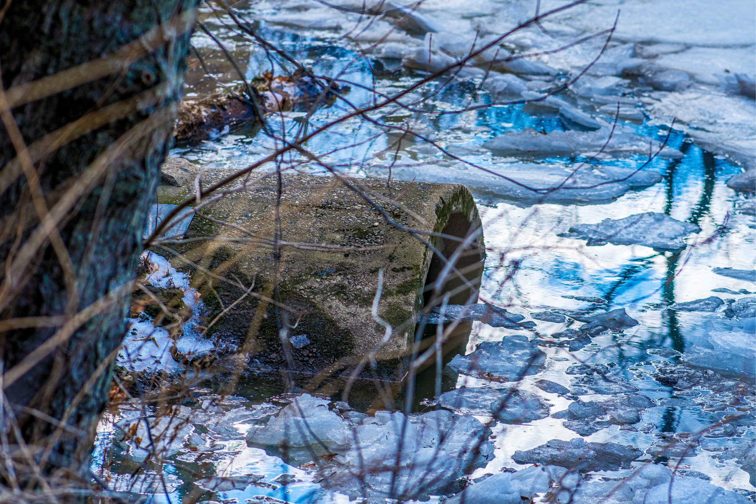
Flooding is regulated through a network of overflow outlets that empty into waterways.
In each case, the goal is to scrap portions of Camden’s Civil War-era infrastructure and replace them with a water management system fit for an uncertain future.
“These are generational investments,” Schreiber says. “A pipe can last 70 to 100 years. We know the world’s going to be different in 70 or 100 years and we know we want a massive investment like this to stand the test of time. I won’t be around, but I don’t want the people coming after me to think, ‘What idiots. They didn’t contemplate climate change despite the fact everyone knew it was coming?’ It’s important that we don’t leave a problem for our heirs.”
To that end, Montalto has also been working on climate modeling in collaboration with the Center for Environmental Transformation, a small community nonprofit using a $500,000 grant from the National Fish and Wildlife Foundation (NFWF) to develop a coastal resiliency plan for Camden that accounts for various potential changes in sea level.
Using Montalto’s models, the organization is identifying a series of greenscaping solutions that harmlessly redirect the flow of water, whose construction the NFWF could support in future funding rounds. The attention this time is above ground, where changes to riverbanks and green spaces could prove critical, says executive director Jon Compton. He knows Camden can’t stop water from rising at its edges or falling from the sky, but it can control what happens once that water arrives.
“One thing Franco has said that’s been very helpful is that our goal with the project is not to eliminate flooding, which is usually impossible, but to allow the city to flood safely,” Compton says.
Residents Clear a Path
Christina Allen, a Waterfront South resident, knows too well what it looks like when Camden floods today.
At 31, she’s lived in the same house her whole life — a house so frequently invaded by water that she needs to light incense to overcome the smell of mold when she enters the basement. As a kid, she used to secretly hope for flooding the way others hoped for snow days, knowing she wouldn’t be able to make it to school if heavy rains came. Now, she’s more troubled by the impassable roads.
“When I know it’s gonna rain a lot, I make sure I get home before it starts flooding,” Allen says. “It’s like a pool.”
Allen is among a group of Camden residents doing their part to reduce flooding. She uses Cleanlet, an app created by Montalto’s team, to identify clogged inlets in the neighborhood that she can clear out with tools provided by Drexel and its partners.
The app’s users can exchange their effort for gift cards — a modest motivator that Allen says is less important than helping out her community.
All the inlets in Allen’s neighborhood are mapped on the app, which can work for any municipality; a town at the Jersey Shore just gave the team data on 250 inlets it hopes to keep clear in the future.
The challenges Allen and her neighbors face are unfortunately common in cities without the means to build their way out of environmental crises. But with academic experts in their corner, Camden and its counterparts can identify the solutions they need and find state and federal support to put them in place.
As Schreiber points out, wealthier communities across New Jersey wouldn’t tolerate these issues, so why should Camden have to?
“Where I live in Haddon Heights, if there was one day with sewage running down the street, there would be immediate intervention,” he says. “In Camden, it’s just part of life here, and that’s totally unfair. You’re talking about quality of life, the dignity that someone feels when they walk down the street during a rainstorm. These things need to be addressed.”
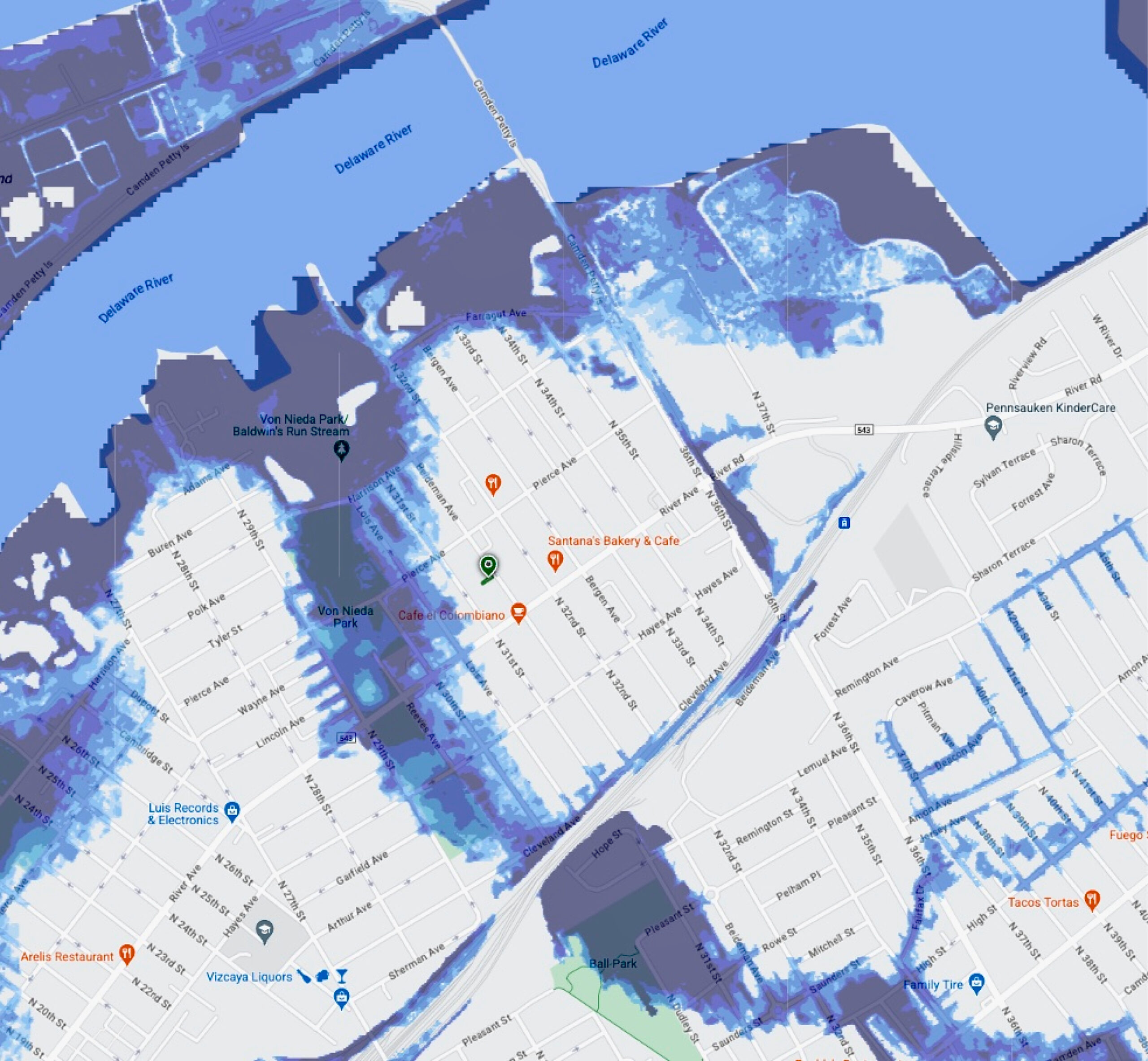
_Cramer Hill, Camden
The section of Camden most vulnerable to storm system flooding is around Von Nieda Park.
_In Philly, a Dashboard for Climate Action
Across the river in Philadelphia, meanwhile, a new report and a Google-backed data dashboard are putting climate justice in the public’s hands.
Leading the charge is the Philadelphia Climate Justice Collective (PCJC), a coalition of four community-based organizations: Nueva Esperanza, Mantua Civic Association, Overbrook Environmental Education Center, and the Southeast Asian Mutual Assistance Associations Coalition (SEAMAAC).
Working with Drexel’s Environmental Collaboratory (TEC) — a university-wide initiative that connects researchers, students and community partners to co-design data-informed, justice-centered environmental solutions — the group published a report late last year filled with neighborhood-specific climate recommendations.
The report tackles urban challenges like heat islands, respiratory health and aging infrastructure, while building community leadership to drive local change. Each group designed its own approach to gathering feedback and setting priorities, ensuring the work reflects real community needs from the ground up.
One recommendation has already gained traction: a public-facing Climate and Environmental Accountability Dashboard to track local environmental health and government action. The idea recently received a $500,000 boost from the Environmental Justice Data Fund of Google.org to build out the dashboard as a community-owned advocacy tool.
The Collaboratory heralds the project as a true community-led process. “It is intended to guide a just climate transition by addressing systemic barriers, promoting resilience and elevating community leadership,” says TEC Executive Director Mathy Stanislaus.